SunTrace3D
Understand sunlight on any building — for solar analysis, planning compliance, real estate, photography, and agriculture. Explore photorealistic 3D models, simulate shadows year-round, and get data-backed insights.
Backed by European Commission satellite irradiance data — generous free tier, no installation required.
Everything you need for sunlight analysis
Powerful tools for solar, compliance, real estate, photography, and agriculture — in one 3D interface
Real-Time Shadow Simulation
Watch shadows sweep across buildings for any hour of any day. Scrub through 24 hours or animate an entire year to find the sunniest spots on your roof.
Solar Panel Placement & Analysis
Click to place individual panels or drag to create arrays on any rooftop or facade. Per-panel shading analysis shows exactly which panels get blocked and when.
Photorealistic 3D Models
Explore any address on Earth with photorealistic 3D city models — buildings, terrain, vegetation, all rendered in your browser. No downloads, no plugins.
Cost & Payback Calculator
See full installation cost breakdowns with local government incentives and tax credits. Know your payback period before you call an installer.
Environmental Impact Dashboard
Track your CO₂ offset, equivalent trees planted, and see which household appliances your solar system can power — from lights to electric vehicles.
Professional PDF Reports
Generate branded site feasibility reports with 3D views, system specs, monthly production charts, and financial analysis. Ready for client proposals.
Building Configurator
Design custom buildings and analyze shadows on planned construction before breaking ground. Test how a new structure affects sunlight on surrounding properties.
18 Languages, 29 Currencies
Available in 18 languages with full RTL support. Costs and savings display in your home currency — automatically detected, with 29 currencies supported.
Request Installer Quotes
Ready to go solar? Request free, no-obligation quotes from local installers directly from your analysis. Your system specs are pre-filled — no re-entry required.
Right-to-Light Compliance
Assess daylight access to neighboring windows using BRE 209 guidelines. Generate shadow impact evidence for planning permission submissions.
Urban Heat Analysis
Map surface heat exposure and shade coverage across urban areas. Evaluate how new construction affects thermal comfort for pedestrians and public spaces.
Film & Photography Planning
Plan shoots around golden hour with precise sun position data. Preview camera angles through virtual lenses in full 3D before arriving on location.
How it works
From address to sunlight analysis in under a minute
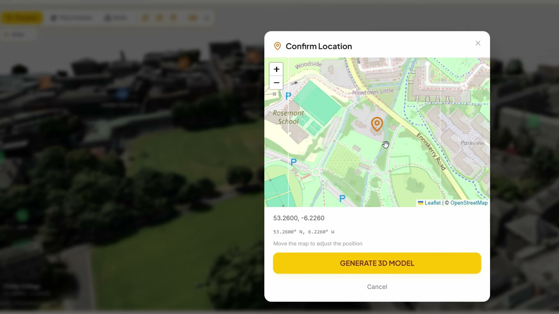
Choose a Location
Search for any address worldwide or click on the map. A photorealistic 3D model is generated for you — no software, no downloads.
Simulate Sun & Shadows
Scrub through 24 hours with the time slider or animate an entire year. See exactly when and where shadows fall on your roof from surrounding buildings and trees.
Get Your Solar Estimate
Place virtual panels on your roof, see per-panel shading analysis, and get annual energy yield and savings estimates backed by European Commission satellite data.
See It In Action
60-second demo — address search, 3D model, solar panels, energy yield
Traditional solar analysis tools cost €2,000–€10,000/year
SunTrace3D delivers the same shadow studies and energy yield analysis — starting free, right in your browser.
Traditional tools
- Desktop software, €2K–€10K/year per seat
- Days or weeks for a report
- Simplified 2D models
- Requires trained specialist
SunTrace3D
- Free tier, Personal from €9/month
- Results in minutes, not weeks
- Photorealistic 3D with real buildings
- Self-service, no training needed
Built for every industry that depends on sunlight
Whether you're a homeowner exploring solar, an architect running shadow studies, or a filmmaker planning golden hour — SunTrace3D fits your workflow.
Homeowners
Find out if solar works on your roof — in 30 seconds, for free. See exactly how much shade your roof gets, how many panels fit, and what you'll save on electricity bills.
Check your roofSolar Installers
Qualify leads remotely before sending a crew. Embed the 3D viewer on your website to capture leads with system specs pre-attached. Generate PDF proposals in minutes.
See installer toolsArchitects & Developers
Run shadow studies for planning permits and urban design. Use the building configurator to analyze sunlight on planned construction. Export professional reports for clients.
Try the configuratorEnergy Consultants
Replace desktop tools costing €2,000–€10,000/year. Use the API for bulk solar potential assessments across entire portfolios. Generate client-ready reports instantly.
View pricingProperty Developers
Analyze solar feasibility before breaking ground. Design buildings in 3D, study shadow impact on neighbors, and calculate solar ROI for new developments.
Plan your developmentReal Estate
Differentiate property listings with solar potential data. Show buyers exactly how much energy and money a property can generate with interactive 3D analysis.
Analyze a propertyGarden & Landscape
Map sunlight and shade patterns across your garden with 3D precision. Plan what to plant where, based on real sun exposure data from surrounding buildings.
Map your gardenUrban Planners
Run right-to-light compliance checks, shadow impact studies, and urban heat analysis for planning applications. Self-service analysis that replaces outsourced reports.
Run a compliance checkFilm & Photography
Plan shoots around golden hour with precise sun position data. Preview camera angles in 3D and bookmark lighting conditions for shoot day.
Scout a locationAgriculture
Map sunlight across farmland, assess crop suitability, and model greenhouse light levels. Data-driven planning based on real terrain and climate data.
Map your landSimple pricing
Start for free, upgrade when you need higher detail
Free
Generous free tier, no credit card
- 3D city model viewer
- Standard detail (SD) models
- Real-time shadow simulation
- Sun path visualization
- Up to 6 solar panels
- Up to 3 scene objects
- Up to 3 custom buildings
- Up to 3 measurements
- Energy yield estimates
- Sunlight heatmap up to 20 × 20 m
- 5 library models per category
Personal
For individuals and personal projects
- Everything in Free, plus:
- HD photorealistic 3D models
- Up to 20 panels, 20 objects & 15 buildings
- Up to 10 measurements & 5 terrain zones
- Save unlimited projects
- Import custom 3D models (up to 10 MB)
- Photo export & compliance reports
- No watermark on reports
- Sunlight heatmap up to 100 × 100 m
- Ground mount arrays (up to 2 arrays, 20 panels)
- Full 3D model library (750+ models)
- Engineering tools: module/inverter catalog, string planning, cable sizing
- Self-consumption analysis, battery simulation & bill of materials
For personal, non-commercial-entity use. Companies and organizations require a Business license.
Business
For companies, installers & consultants
- Everything in Personal, plus:
- Unlimited solar panels & ground mount arrays
- Unlimited objects, buildings & measurements
- Unlimited heatmap area (up to 1 km)
- Real estate scoring & PDF reports
- Custom logo & branding on reports
- Import 3D models up to 200 MB
- Custom Super HD & hyper-realistic models on request
- Embeddable 3D viewer & lead capture
- API access (500 HD models/month)
Enterprise
For large organizations
- Everything in Business, plus:
- Custom Super HD & hyper-realistic models included
- White-label branding
- Custom CRM integrations
- Custom API volume
Built for integrations
REST API for generating 3D models and calculating solar energy. Embed interactive 3D views on your website.
REST API
Generate HD 3D models programmatically. Retrieve model status, calculate solar energy yield, and manage API keys.
curl -X POST https://api.suntrace3d.com/v1/analyze \
  -H "Authorization: Bearer YOUR_KEY" \
  -d '{"address": "123 Main St, Berlin"}'
API Documentation Embeddable Viewer
Add an interactive 3D solar view to your website with a single line of code. Responsive, mobile-friendly, and customizable.
<iframe
  src="https://embed.suntrace3d.com/v
    ?key=YOUR_KEY&address=Berlin"
  width="100%" height="500">
</iframe>
Embed Guide Frequently Asked Questions
Quick answers to common questions about solar analysis with SunTrace3D.
Is SunTrace3D really free?
Yes. The free tier includes the full 3D viewer, shadow simulation, solar panel placement (up to 6 panels), and energy yield estimates — no credit card, no sign-up required. Personal unlocks high-definition models and expanded limits for individuals at €9/month. Companies need the Business plan at €99/month.
How accurate are the energy yield estimates?
Energy estimates are based on satellite irradiance data maintained by the European Commission, the same dataset used by governments and utilities for solar policy decisions. The calculations account for panel tilt, orientation, local weather patterns, and shading from surrounding buildings.
Will solar panels work on my roof?
SunTrace3D shows you exactly how much sunlight reaches every part of your roof throughout the year. You can place virtual panels and see per-panel shading analysis — so you'll know which roof sections produce the most energy before you contact an installer.
Do I need to install any software?
No. SunTrace3D runs entirely in your web browser on desktop and mobile. There's nothing to download, install, or configure. You can also install it as an app on your phone or tablet for quick access.
What locations are supported?
Any address on Earth. Photorealistic 3D models are available for cities worldwide, and the solar irradiance database covers every location on the planet.
How is this different from other solar calculators?
Most solar calculators use flat satellite images or generic estimates. SunTrace3D uses photorealistic 3D city models with real buildings, terrain, and vegetation — so you can see actual shadow patterns from neighboring structures, trees, and topography. Professional shadow analysis tools cost €2,000–€10,000/year; SunTrace3D starts free.
Can I use SunTrace3D for my solar installation business?
Yes — companies and organizations need the Business plan (€99/month), which includes unlimited solar panels, ground mounts, objects, and measurements, plus HD models, PDF site reports, and custom branding. It also includes an embeddable viewer, lead capture, and API access. The Personal plan is for individuals only.
What languages and currencies are supported?
SunTrace3D is available in 18 languages including English, German, French, Spanish, Italian, Arabic, Japanese, Korean, and Chinese. Costs and savings are shown in 29 currencies, automatically detected from your location.
Can I use SunTrace3D for non-solar purposes?
Yes. SunTrace3D serves multiple industries beyond solar: urban planners use it for right-to-light compliance and shadow impact studies, filmmakers for golden hour and camera placement, real estate agents for window view analysis, and farmers for crop suitability mapping.
Does it support planning permission shadow studies?
Yes. The compliance tools include BRE 209 right-to-light analysis, full-year shadow impact simulation, and professional PDF reports. Architects and urban planners use these for planning submissions, replacing outsourced studies that cost €500–€2,000 each.
Secure & Private
Your data stays private. No tracking, no analytics on your locations.
No Installation
Works entirely in your browser. No downloads, plugins, or sign-ups required.
Global Coverage
Worldwide photorealistic 3D city models. Works for any address on Earth, from small towns to major cities.
Ready to see what sunlight can do for you?
Explore any building in 3D, simulate a full year of shadows, and unlock insights for solar, compliance, photography, and more — free, no sign-up.