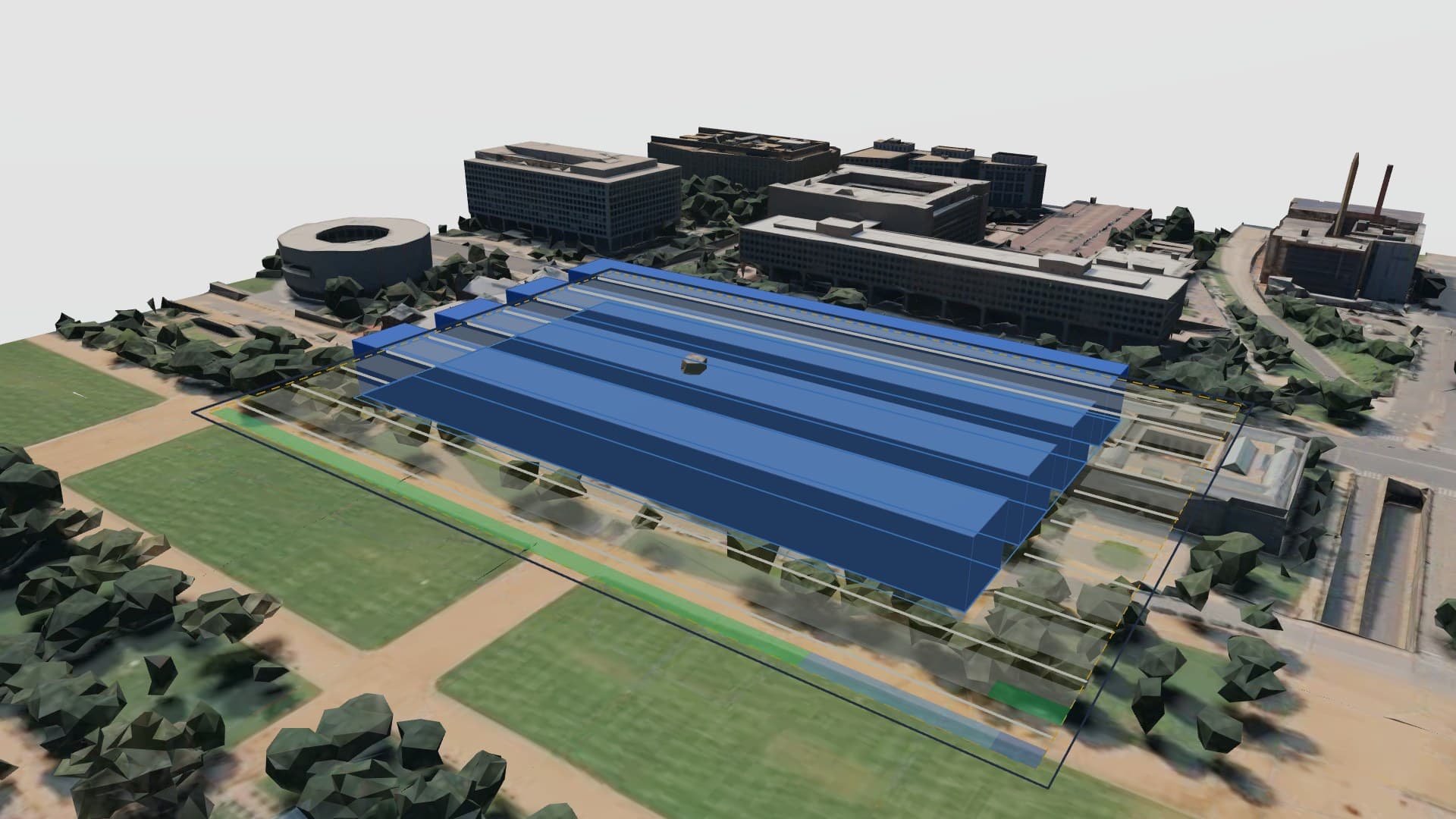
Know what a site yields before you commit
Draw the parcel, set the constraints and choose what to build. Units, parking, cost and a zoning check solve live — on the real 3D terrain and streets around it.
Without SunTrace3D
Weeks for a first answer
A yield study waits on an architect’s availability, so sites are lost or bought before the numbers are in.
Spreadsheets without a site
Density, parking and cost worked out apart from the geometry drift from what the land can actually hold.
Constraints discovered late
Setbacks, easements, access and zoning surface after the offer, when changing course is expensive.
With SunTrace3D
A scheme in minutes
The guided start goes from parcel to a solved scheme with units, FAR, stalls and height in four questions.
Numbers tied to geometry
Floor area, parking, quantities and yield are measured from the solved buildings, so every change moves them together.
Constraints up front
Setbacks from the real streets, easements, drives and a zoning check are part of the first solve, not a later surprise.
Site Planning & Feasibility
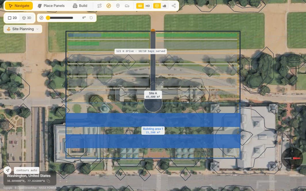
Draw a parcel and see what it yields — units, floor area, parking, cost and a zoning check — solved live on real 3D terrain. Business and Enterprise.
Setbacks from the Real Streets
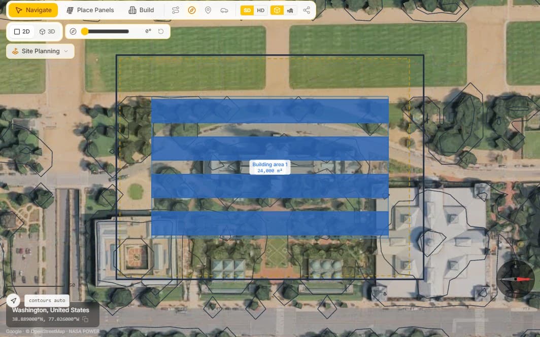
Parcel edges are labelled front, side or rear from the roads around the site, each with its own setback and a per-edge override.
Six Building Typologies
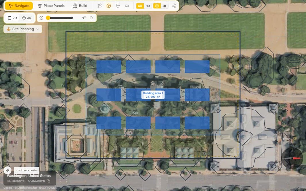
Bars, podium, garden walk-up, wrap, industrial and data centre — each packs the site by its own rules and reports its own figures.
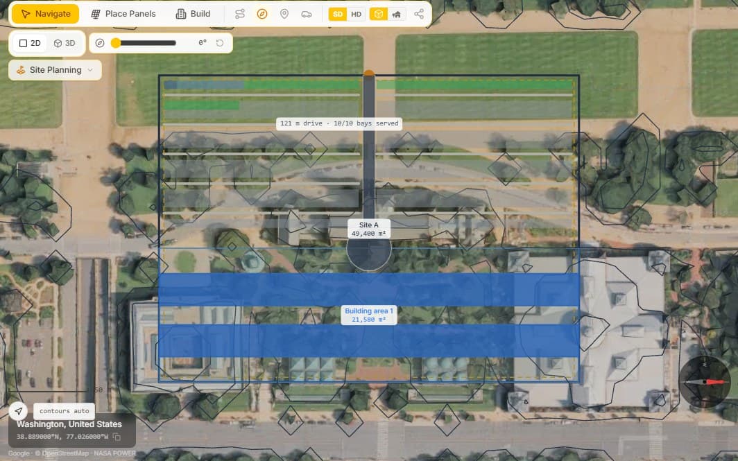
Parking & Circulation
Surface, deck or basement parking, with drives that enter from the frontage, reserve their ground and report any bay they cannot reach.
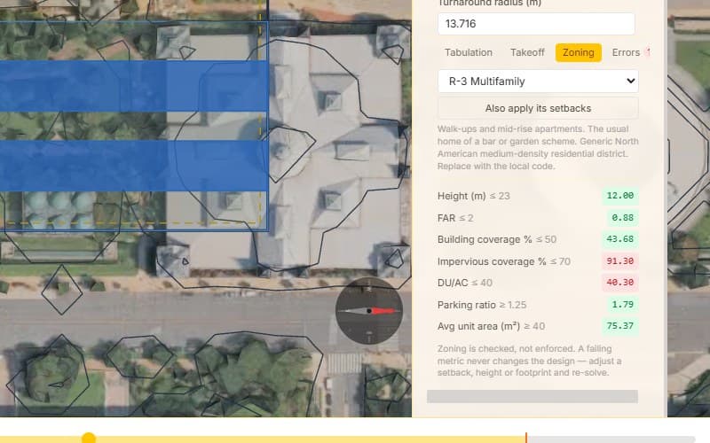
Zoning Checker
Pass/fail chips for FAR, height, coverage, density and parking. District presets fill it in one step; rules never change the design.
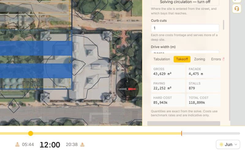
Takeoff & Pro Forma
Gross area, facade, paving and stalls measured from the geometry and priced, so a changed setback moves the yield.
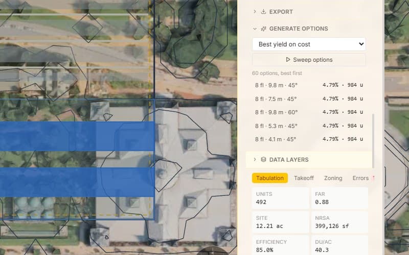
Generate Options
Sweep floors, setbacks and stall angle and rank every option by units, FAR, yield on cost, parking or cost.
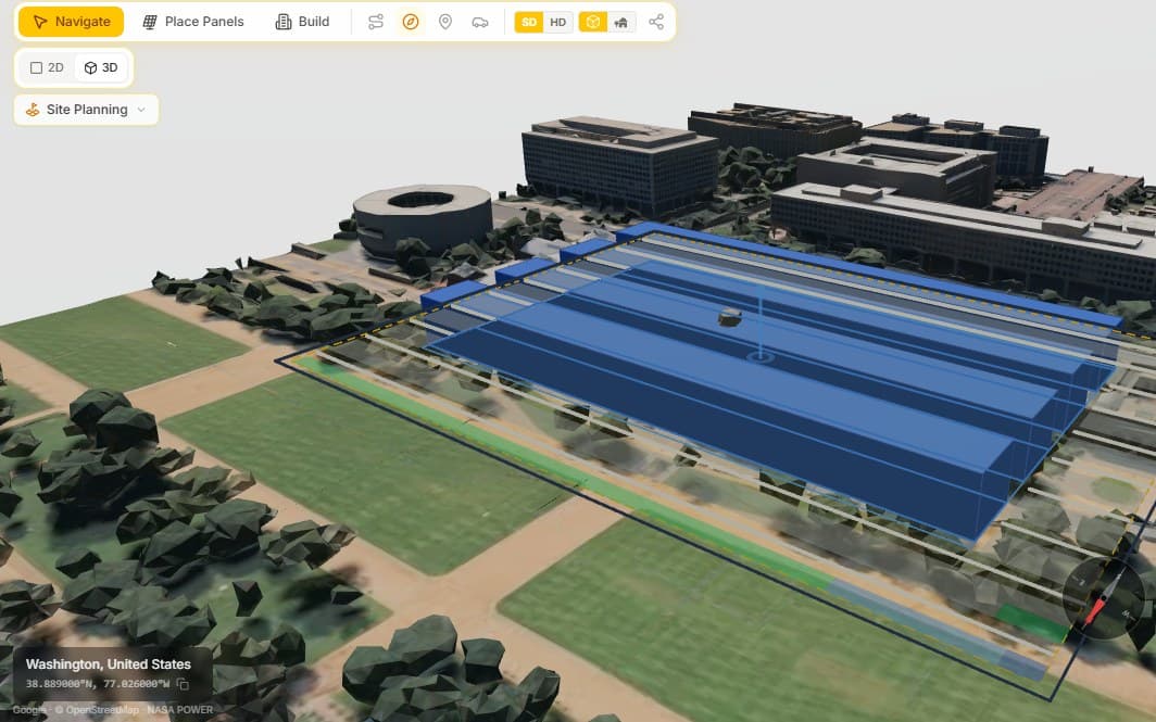
3D Massing on Real Terrain
See the scheme standing on the photogrammetry of its real surroundings, then export the plan to DXF, SVG and CSV.
How It Works
From parcel to a solved scheme in minutes
Draw the parcel
Draw the boundary on real 3D terrain or take it from the model. Setbacks are labelled from the surrounding roads.
Choose what to build
Pick a typology, floors and a unit mix, and add parking and circulation. The scheme solves as you go.
Check, compare, export
Check zoning, compare schemes and generated options, then export to DXF, SVG and CSV.
Frequently Asked Questions
Which plans include Site Planning?
Site Planning is part of the Business and Enterprise plans. Free and Pro accounts can see the tool and upgrade from inside it.
Does it look up the zoning for my site automatically?
No. You check a scheme against zoning rules you set, or start from a generic district preset. Presets use typical North American values and are a starting point — replace them with your local code before relying on the result.
Will it change my design to meet zoning or parking requirements?
Never. A failing rule, a parking shortfall or an unreachable bay is reported so you can see the trade-off and decide what to change. The solve does not quietly shrink buildings or delete stalls.
What building types can it model?
Six typologies: double-loaded bars, residential over podium, garden walk-up, wrap around a parking deck, industrial big box and data centre. Each follows its own rules and reports its own figures.
Can I take the result into CAD?
Yes. Export the plan as DXF with parcel, envelope, buildings and parking on named layers, as SVG for documents, and the quantity takeoff as CSV.
Ready to Start a site study
Start free — no credit card needed